Welcome to the Washington County Land Use & Transportation 2nd Quarterly Update - a newsletter for all things LUT!


View as Webpage

Thumbnail image of a steelhead trout underwater.

Fish passage culverts support habitat access

Blocked streams can be matter of life and death for the many species of fish that navigate the watersheds of Washington County. When bridges or culverts need replacement, our staff work to design and build new culverts that allow fish to access their habitat.


Senior Environmental Resource Specialist Tim Sautter makes sure that culvert replacements comply with regulations and help fish thrive in our waterways. 

Learn more about fish passage

SNR: A Focused Look at Fish and Wildlife Habitat

Our SNR: A Focused Look at Fish and Wildlife Habitat project will update the County’s natural resource program, including limited changes to the County’s inventory maps, policies and land use regulations.


We are looking at our fish and wildlife habitat regulations related to Statewide Planning Goal 5. The project will update the resource inventory and analyze the impacts and consequences of allowing uses that could conflict with habitat resources.

Read about the study

Stay prevents residential development in some SNR areas

A stay issued by the state Land Conservation and Development Commission (LCDC) will prevent LUT from approving some new land division and development applications for residential projects that would impact areas with County-mapped Wildlife Habitat. The stay is in effect until our Goal 5 work is completed.


Review our FAQs to find out if your property is impacted by the stay and what we are doing to have the stay lifted.

Learn more

Reminders: Development Review and Building Services

July brings some fee and one-time lobby hours changes for our Building Services and Development Review work groups.


  • Fees for building permits and land use applications will be increasing 50% starting July 1. The fee increases are providing critical funding to support adequate staffing to help ensure target service levels are met. 


  • Our third-floor lobby will be closed for in-person services from July 3-7 so staff can catch up on applications and update computer systems.
See media release

Landslide stabilization work in progress

Washington County’s hills and slopes are beautiful, but they also increase the risk of landslides. Our Operations and Maintenance Division staff identified three slow-moving landslides impacting County roads. We are developing plans to stabilize each and to improve the strength of our transportation network.

Timber Road

Timber Road remains closed between Strassel and Cochran roads. In March, we discovered the landslide activity near the S curves was increasing. Since then, pavement cracking and settlement in the travel lanes has worsened. We are completing a geotechnical evaluation to determine possible stabilization solutions. We expect results in September.

Learn more

Scoggins Valley

Construction on five landslide stabilization projects on Scoggins Valley Road and West Shore Drive around Hagg Lake began in 2015. The final project near Forest Dale trailhead finished this month (June). In the process, we discovered another active landslide near Cherry Tree trailhead. We’ve set up a barrier on the inner shoulder to protect people from traveling on the damaged pavement while we develop stabilization plans.

Learn more

Bacona Road

A landslide is causing erosion at the edge of Bacona Road, about three-fourths of a mile from the end of the the pavement. We will stabilize the landslide and repair the road where needed.


Construction is expected to begin September. 

Learn more

Public supports Council Creek Regional Trail

We appreciate the participation by more than 775 people who responded to our Council Creek Regional Trail survey in April and May.


Almost 90% of respondents support the trail. Restrooms, benches, lighting and landscaping/trees were among the top-requested trail features.


The comments and survey responses will guide us as we continue planning for the Council Creek Regional Trail. 

Learn more about the trail

Give feedback on Pedestrian & Biking Improvement Project proposals

The Urban Road Maintenance District Advisory Committee (URMDAC) will seek community feedback on a list of potential Pedestrian and Biking Improvement Projects during an online open house July 21-Aug. 6.


The list of proposals, totaling about $2.4 million, must be trimmed to $1 million. Your comments will help URMDAC members create a final list to recommend to the Washington County Board of Commissioners for adoption.


There is less money for projects than we had previously due to budget limitations.

Read about the URMD budget

Transportation News

209th Avenue

209th Avenue is being widened between Alexander Street and Kinnaman Road.


Speed limits in the construction area have been lowered to 35 mph.


Traffic south of TV Highway was shifted to the west side while the old lanes are rebuilt. Bike paths and sidewalks are complete on the west side of the street, and irrigation is being installed for landscaping.


The road north of the highway is being widened. Construction on TV Highway is underway. Traffic lanes were shifted. No left turns are allowed in the construction zone.

Read more
Tualatin-Sherwood Road Highway 99W crossing

Tualatin-Sherwood Road/Roy Rogers Road Hwy 99W

Half of the road widening between Borchers Drive and Langer Farms Parkway is complete. A northbound lane has been added on Highway 99W, as well as additional lanes at the Tualatin-Sherwood Road/Highway 99W intersection.


Willamette Water Supply water transmission pipeline installation is nearly complete in this area.


We will finish road widening this summer. New traffic signals will be installed through the winter. Final paving and striping and scheduled for summer 2024.

Discover the latest

Reedville Trail

We are improving Reedville Trail and installing pedestrian crossings between Baseline Road and Johnson Street.


The trail is closed at Reedville Creek, between Rock Road and Augusta Street, while we install a pedestrian bridge.


Construction north of Augusta Street will be mostly finished before school starts in September. The remaining trail improvements will be complete by the end of November.

Visit Reedville Trail

Speed limits

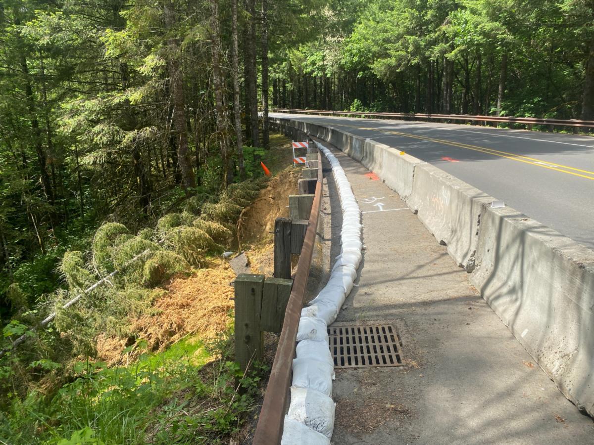
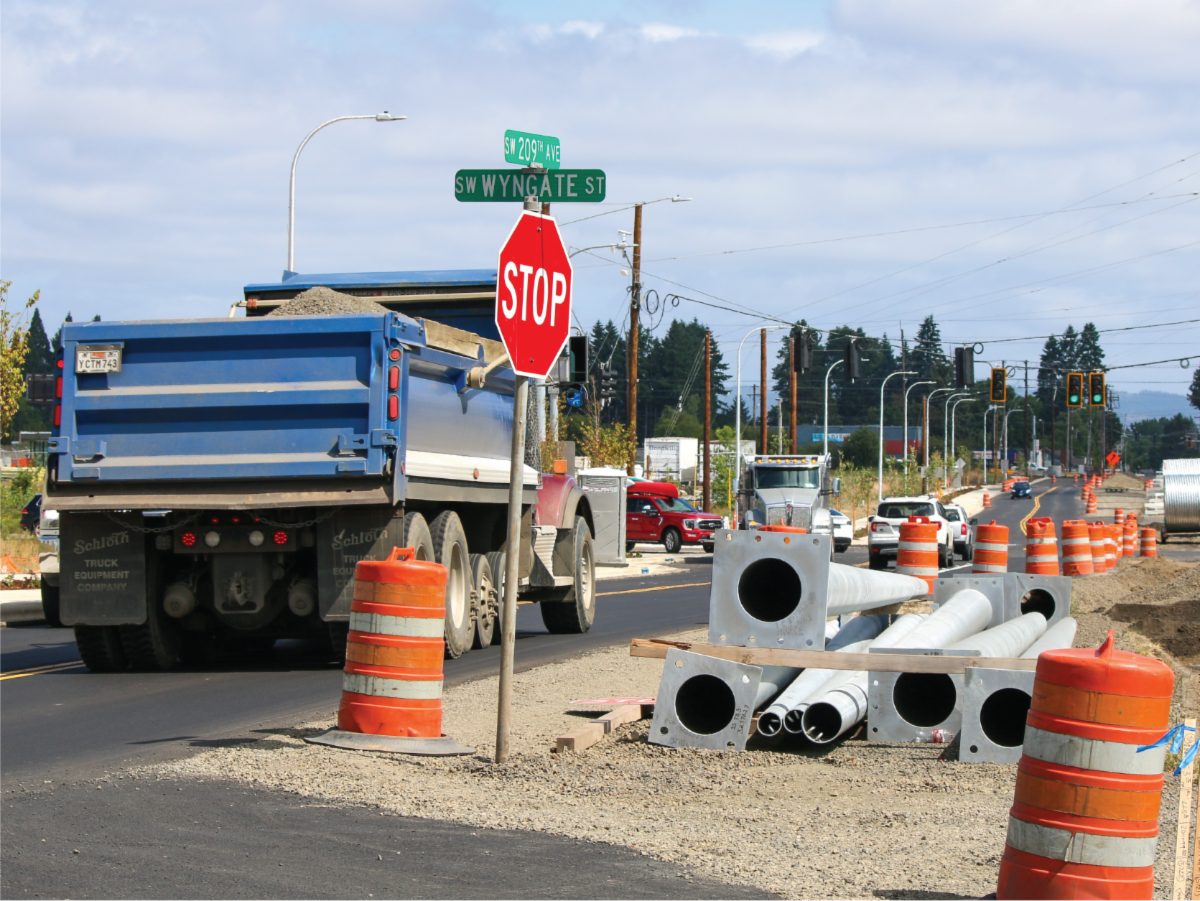
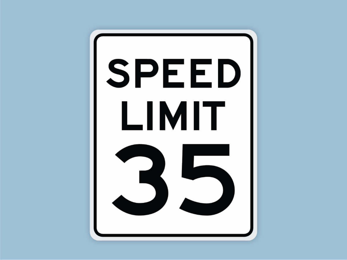
Speed limits are set to help drivers travel safely. Speed limits on our roads and streets are set by the Oregon Department of Transportation (ODOT), in accordance with Oregon law. Speed limits must be reasonable for the road.


When no sign is posted, drivers must follow speed limits set by state law.


When asked to lower a speed limit, we must verify that a speed change would follow the rules. Then we submit the request to ODOT.


Speed limit changes are carefully evaluated. It may take many months to receive a decision on speed limit changes.

Learn more about speed limits

Upcoming Events

July 22

July 21-Aug. 6

July 28 & 30

Join us at Viva Tualatin

Pedestrian & Biking

Improvement Projects

Online Open House

Join us at the

Washington County Fair


Aug. 1

Aug. 5

Aug. 10

Join us at the Cornelius

National Night Out 

Harleman Park

Join us at THPRD's Big

Truck Day Conestoga

Recreation Center

Join us at the Bethany

Village Safety Fair

Aug. 11

Aug. 18-Sept. 18

September TBD

Join us at the Elephant

Garlic Festival North Plains

Draft ADA Transition Plan for

Public Right-of-Way Online

Open House

SNR: A Focused Look

Online Open House

September TBD

Sept. 2

Sept. 7

SNR: A Focused Look

Community Forum

Join us at the Cedar Mill

Farmers Market

Join us at the Aloha

Farmers Market

Facebook  Twitter  Web  YouTube  Email

Washington County Department of

Land Use & Transportation

www.washingtoncountyor.gov/lut